Saving Earth with Space Tech
When we hear the words “Space Tech”, we often think of rockets, astronauts, Mars Exploration Rovers, NASA, etc., but this is only one side of the coin. The other side involves using space technology to improve (or shall I say, save) life on Earth—which is the focus of the lab that I’ll be working in this summer.
It’s been two weeks since I started. After two days of orientation and trying to remember names, I went ahead, printing around seven (7) journal articles about my lab and my project. I started on the one about the lab that pretty much explained its necessity: Space Enabling Earth.
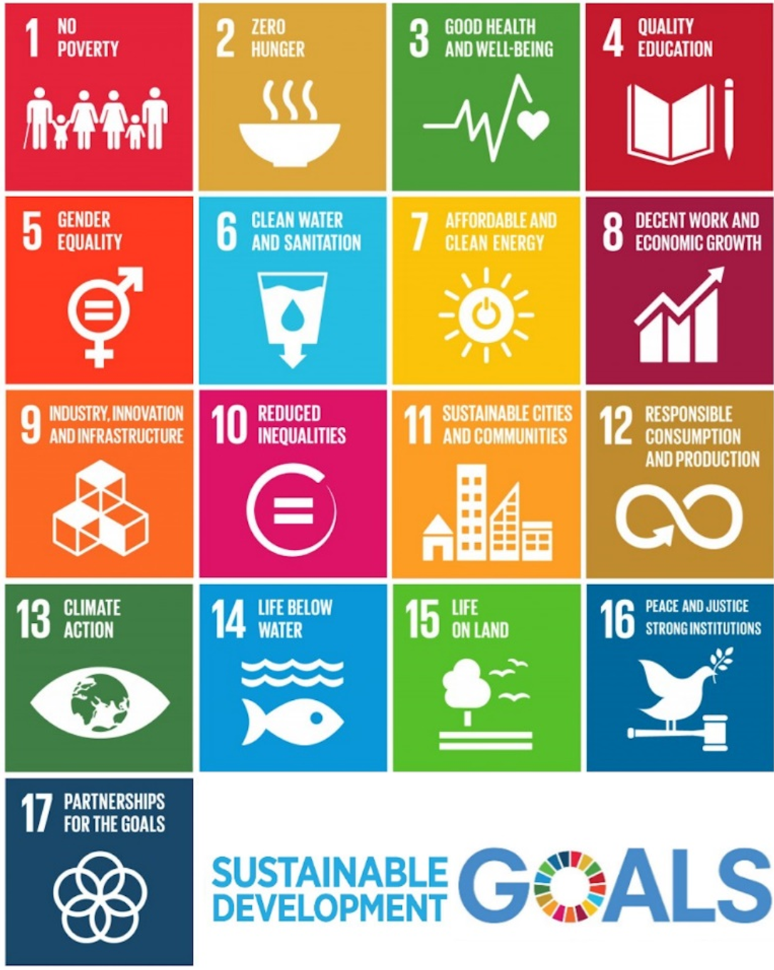
As the world continues to heat up, life on Earth continues to suffer, especially those who don’t have the systems in place to combat the symptoms of climate change. The United Nations, thus, has focused its efforts on helping developing nations adapt to the new world and educating all countries to mitigate the impacts of climate change by establishing the 17 Sustainable Development Goals (SDGs). All nations are encouraged to pursue such goals as part of their national development strategy. As we attempt to show the next generations the beauty of life here on Earth, we are all tasked to monitor and meet such targets by 2030.
Not to cause any panic, but there are only 6 years left, and the situation has not gotten any better. Currently, the lab has identified several technologies related to space that might help in realizing these goals—satellite communication, satellite navigation and positioning, microgravity research, and most importantly, satellite Earth observation.
Satellite Communication
Do you remember the information highway that connects all people in the world and lets us share tons of information with one another? Well, it turns out that the Internet is not accessible to almost 2.9 billion people—that’s more than a third of the global population 1. Satellite communication systems, fortunately, can be used to close this gap and help developing nations progress towards SDG 9 (“Industry, Innovation, and Infrastructure”) and SDG 4 (“Quality Education”). A great example when this was used was during Supertyphoon Haiyan, the strongest typhoon ever recorded in Philippine History leaving multiple regions devastated. Ground Air Transmit Receive (GATR) satellite communication system was employed to preserve communications between victims and disaster relief professionals.
Satellite Navigation and Planning
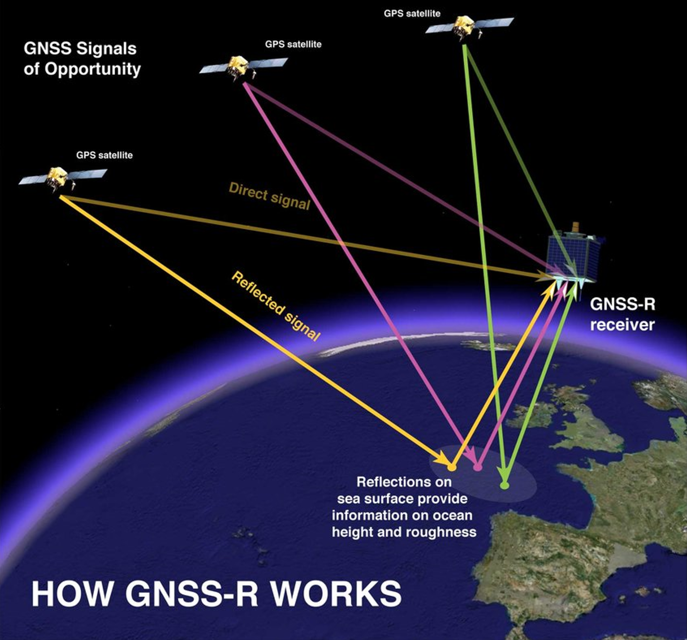
The only reason why people are never lost in some countries is because of the Global Navigation Satellite Systems (GNSS), a multi-laterally operated system consisting of what we people typically refer to as the Global Positioning System (GPS). Such a system can speed up the transport of goods and “alleviate traffic bottlenecks” 1. It could also track the movements of endangered species to help monitor and preserve wildlife, advancing SDGs 14 (“Life below Water”) and 15 (“Life on Land”).
Microgravity Research
Microgravity, a state of almost experiencing weightlessness in the International Space Station (ISS), can also expand the borders of medicinal research. Currently, the ISS National Laboratory is letting biotech firms conduct microfluidic research that involves testing an ultra-thin pump for delivering medications through the skin. It can also produce cardiac-like tissues that can only be made in microgravity conditions. This will revolutionize organ transplant procedure, hitting SDG 3 (“Good Health and Wellbeing”).
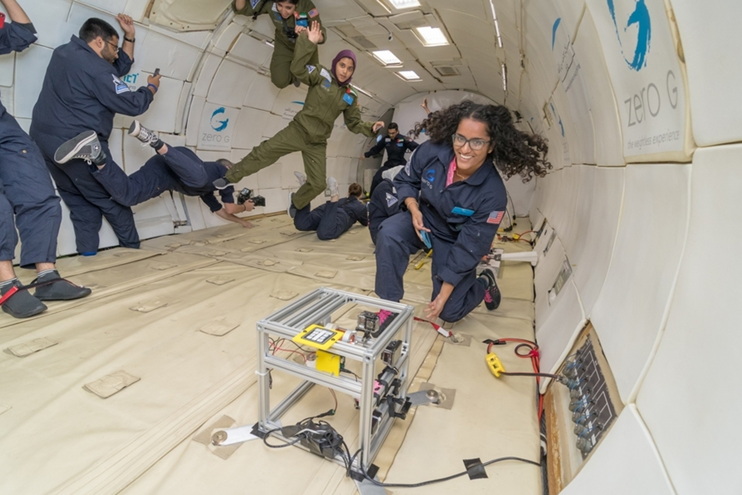 Space Enabled Research Group in the ISS National Lab. Source: MIT News
Satellite Earth Observation
Recently, there has been a significant increase in the number of micro- and nanosatellites brought to space from different countries - one of which is the Philippines – and other developing nations in Southeast Asia and Africa. You might be surprised. How can we afford to even send one? These satellites are not used to conduct astronomical and extraterrestrial exploration research. Most of them are used to send essential data back to the ground. These include but are not limited to:
- Atmospheric and weather variables;
- Near-infrared radiation (NIR) data that help monitor the amount of vegetation;
- True color images to view areas that are hard to reach by land;
- Light reflectance percentage to monitor particle (aerosol) concentration in the atmosphere and track polluted areas;
- Identify potential fishing zones;
- Tracking land cover and the presence of radiation-absorbing infrastructure contributing to the rise of temperatures in urban areas (my independent study last Spring 2024);
Finally, satellites can also be used to track soil moisture content in agricultural areas to help detect drought-prone areas which is one part of my project this summer. Specifically, I will be working on building a model that characterizes the socioeconomic vulnerability of areas. This model is crucial for policymakers to have to allocate the limited amount of resources effectively. My mentor and I are still narrowing this topic into a research question that I’ll explore in the next few weeks.
I am really excited to contribute to the lab’s mission which I resonate with. There are a lot more space tech out there waiting to be used. Some efforts by space tech companies like SpaceX involve finding a new host planet like Mars. But maybe, just maybe, there is still hope to save our home planet by shifting our focus down (not up).